The road was in average condition and after winding through a landscape of stunted low bush land, opened up into the salt bush wide open country of the Nullarbor. With this change came the deteriorated, rocky condition of the road. This made for slow going, zig zagging and dodging large rocks on the road, most embedded into the clay surface.
In a few places along the length of that road you would come to a spot where at the side of the track would appear flat areas of exposed rock and in the centre a hole, some large and some small.
First one we came across was shallow and with water and grass growing in it, others were openings to large caverns, which when looked into, were caves disappearing into dark depths.
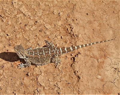
Scattered along the way were the usual wombat homes and signs of camels, though we didn’t sight any, Did pass some lizards, some slow to move and some very quick.
Two and a half days later we arrived at Forrest, a former meteorological station, the whole infrastructure of the former town was bought some years back by someone and now offers a campground for travellers. It is also the site of an airstrip and is used by the royal flying doctors and a lot of private aircraft, as well as companies. It is a convenient fuel stop for aircraft travelling from Perth to Adelaide and reverse. While we were there, a helicopter dropped in for refuelling and a stop for the night, as the pilots were ferrying the air rescue aircraft to Perth from Adelaide.
Stayed two days at Forrest and did some washing and treated ourselves to a meal provided by the managers of the business, while having a very interesting chat to the pilots.


No comments:
Post a Comment