Sunday, 13 July 2025

Carnegie to Wiluna


With the road improving out of sight, we made good time, Carnegie Station wasn’t that far.


Slowly rolling through the gate, we pulled up at the little campground. They offer, camping, meals, and basic supplies. We weren’t camping but wanted to have a look around. The campground kitchen, which also feeds the station workers, has a wall of info on the Gunbarrel and Len Beadell, with photos. After a look, and a chat with the camp manager, we bid farewell and were back on the road.


 Mingol outcamp was a way down the road, and when we reached it we stopped and had lunch. The old station out camp was situated on a water hole that seldom went dry, and there was water in it with water birds enjoying the cool.


 The old shelter, complete with what was left of an old wood stove, had shaded and fed many a ringer in its day. This would have been a good camp, but it was still early, so we kept on.


 After two more days, traveling and camping on the road, we reached Wiluna, our last point of civilization for 1000k. The small Community has a small supermarket and fuel stop, both of which we needed. So, it was time to restock and refuel, and recheck we had all that was needed for our next adventure, up the Canning Stock Route.


Friday, 11 July 2025

Toward Carnegie


Breaking camp in the morning, we continued across the Gunbarrel. As always, the terrain changed throughout the morning. 


Eventually, we came to a junction, where another of Len Beadells roads, the Gary Highway, met the Gunbarrel. The junction was called Everard Junction. Another of Lens plaques was there as well as a tin, with odds and ends travelers had left, and a book to sign and leave a comment. We did and moved on.


 Passing more wrecked vehicles and trailers, it reminded us how careful you have to be in the remote outback.  


More natural scenery was a pleasure to the eye, even the malley scrub has its own beauty.

Some of the gums out here were so white and with twisted shapes, standing out amongst the reds and green.


The day was wearing on, so a camp was scouted, and that was it for the day.

Geraldton Bore was our next day's destination, it had a working pump and good water, according to our information. As you turn into the bore area, there is one more of Lens plaques on a tree. This was a more than overnight camp, the shower was put up and a pot of water put on for hot water.


With the fire going and coals building up, it would be a shame to waste them, so, a roast lamb was prepaired and cooked in the camp oven on the coals. Next, I whipped up a butter cake mix with mixed fruit mixed in and that was soon baking on the coals too.


Spent a restful couple of days there then moved on down the track. Coming to a clear area, we noticed a lot of camel bones scattered all over. Probbebly shooters controlling the numbers out here. They should make an industry out of camel meat and the hides, rather than just shoot and drop, feeding the wild dogs and cats.

 The track was improving after Geraldton Bore, we were entering Wiluna Shire and getting onto graded tracks. Mangkilli Claypan came into sight, a large claypan, after the claypan, thankfully dry, because we had to cross it.


After the claypan, Mt. William Lambert jutted out of the surrounding plain. There was a track leading to the top turning on to it we wound our way up. Views from there were epic, the flattened landscape spred before you, going on for weeks, confirming the enormity of this country.


Further up the road, someone had perched a truck, with a car on the back, on top of a mound, as a tribute to all the vehicles that hadn't made it. Our camp for the night was called the Oval, complete with a couple of steel pipes as goal posts. We turned in, then drove through the posts and camped up.


Carnegie Station was not too far off, then about 300k to Wiluna and the start of The Canning Stock Route. this track, The Gunbarrel was a test run for the Canning, without the sand dunes, and it was going well so far. but it wasn't over yet.


Mt. Beadell

 The day started as others, orange sky, with the golden orb of the sun peeking over the horizon. With breakfast done, and all packed securly away, I did my rounds of Ned, checking all was still good, and doing the final pack up, as Din set off for her morning walk up the track.


When all was deemed ship shape, I climbed in and ambled off. Catching up with Din, it was all abord and I received a report of the animal tracks and interesting plants on her route. 


The track continued to provide an interesting drive. More washouts, then corrugations till it changed back to holes and washouts, with a few rocks thrown in for good luck, as well as closed in bush.


Mt. Beadell loomed out of the surrounding bush, a prehistoric mount dominating the landscape. It is named after Len Beadell, and a caged in theodolite sits on its summit as a tribute to the surveyor's achievements in building the thousands of kilometers of roads in the harsh Australian outback. Len, as well as an explorer, was also a talented artist, and some of his cartoons were displayed on the info board.


 Stopping for a cuppa, we took in the spectical of the surrounding countryside. Soon it was time to go, so we left, bumping, and crawling our way west. Soon, the country opened up to a grassland plain, stretching into the distance.


When camp time came around, a suitable area was selected, and another day of adventuring came to a close.


Wednesday, 9 July 2025

Gunbarrel day 2


As we moved deeper into the desert, the track got rougher. Through patches of corrugations, then a rocky stretch that threatened to slice the sidewalls of Ned's tires. Then washouts, where storm waters had rushed along, or across the track, and gouged out holes and rocked us threateningly as we rolled over them.

Soon the track closed in, mulga, on both sides hugged the track, giving Ned a brush and a scratch on the sides on the way through. He is a tough old boy, and we squeezed through quite a few tight patches without damage, but with the marks to remember it.


A large rock cairn, at the side of the track had us wondering who had built it and why. There was a bit of work involved by the look.

 Further along, a camel came into view, a big guy, looked like he had a slight limp. After checking us out for a bit, he moved on, probably wondering what we were doing in his back yard.


Another sight, which was to become familiar, was, trailers, of different sizes, abandoned, with various broken bits, testifying to their demise. A good, well-built trailer could, and have, done this track, but it is a punishing drive and only the tough equipment will survive.


The next bore was coming up, and I had a couple of containers to top up, so we pulled in and got the old girl working, the pump too.


Corrigations were back, some say to speed over them, to reduce the rattle and bang, it can feel a bit smoother, but believe me your suspension feels it all, and will distruct sooner than later. I find a slower pace, with well reduced air pressure in your tires is kinder to the vehicle, and you, in the long run.


Another day was closing, so, a clear area was chosen and that was home for the night, where checks were made over the truck and another desert sunset was enjoyed.


Thursday, 3 July 2025

The Gunbarrel Day 1


Warburton road house loomed in the distance as we bumped down the Great Central Road, having just come across form Wingellina and our mining camp resort. This was to be the last fuel stop for another 800 or more ks, so all tanks were filled and we set off again.

The turn off for the Gunbarrel was 20k up the road, finding a pull off about 15k up, camp was set. With a superb desert sunset firing rich reds across the horizon, we settled down for the night.

 Waking in the morning, with anticipation we set off for the turn off. The Gunbarrel is a well-known track pushed through the desert by Len Beadell when he did the roads for the atomic test sites at Maralinga in the 50s and 60s. It hasn’t been maintained since and is known for its rough condition with closed in bush along its length. There are some bores with hand pumps scattered along, but some don’t work, so you have to be prepared and self-sufficient, we were.


Turning off The Great Central Road we ambled up The Heather Highway, which would take us, firstly West, then North to meet up with the Gunbarrel proper. Camels were sighted along the road, grazing on the verge, moving off as we approached.


90Ks of bone rattling corrigations and we hit the track we were looking for. Another 10 or so, a plaque on a tree caught our eyes, one of Len Beadell's markers he put at strategic places on all his roads, marking directions and milage to key points from that position. Opposite the tree was a track into the first bore. We followed it in and set up camp for the night.


Unfortunately, the pump on the bore didn’t work, but we were full of water anyway. In the morning, dark clouds were forming and soon, spits of rain fell. As the morning progressed, so did the rain, as it was only going to be this weather for that day, we elected to stay put and wait it out.

In the morning, the clouds had gone, the surrounds looked crisp and washed. Some of the gums were flowering and put on a great display. The ground was wet, but not boggy, so all was good.


Standing outside, I could hear a low gurgling rumble a little way off and recognized the call of a camel.

 Walking out of camp for a way, into a small clearing, I could still hear the camel in the distance. Then I saw, in the bush, the start of the herd galloping across the plain. Others followed, maybe I had spooked them, or the calling male was in the mood and the girls weren't.


After breakfast, we packed up and prepared for another day on the Gunbarrel.


Wednesday, 2 July 2025

ALICE TO GUNBARREL


Next stop Yulara. After a roadside camp we rolled into Yulara, then promptly fueled up to full capacity, fuel tank and all 7 jerry cans full, the way we were going, fuel stops were few and far between.

  Out of Yulara and on to the Docker River Road, the start of the Great Central Road.


 We had travelled this road before, some 29 years before, and were a bit saddened at the improvement of the road. Now a wide graded gravel road, vastly different to the corrugated rough track we had traveled so long ago. Took some of the adventure out of it, well to our mind anyway.

 Soon we were at Docker River Community. A run-down campground is just past the entrance to the community, and we pulled in for the night. It is a free camp now, but once it was a paid camp with toilets and hot showers, but the bore suppling water there had gone dry, so all the toilets and showers were locked up unusable. Never mind, it was in a nice setting, amongst the gums very pleasant.

 In the morning, always looking for an opportunity, a couple of locals came around wanting to know if we wanted to buy some paintings done by them. They were good and just up Dins ally. After a bit of haggling, we bought one, all were happy with the deal, and they took off with a beep of the horn. Soon after some more came over and offered a deal not to be refused. To their disappointment, I informed them the others had all my money, they left without a beep of the horn.

 Packing up, we headed west. Giles Mulga Park Road was about 75k down the road, this would take us to Wingellina,


Wingellina, the community where our friend's mining camp was just outside of. With the aid of our Starlink technology, we gave him a ring and told him we were on the way. He was pleased to hear from us and said we were welcome and gave us directions to the camp.

 Rolling into the camp in the afternoon we met up and he directed us to the back of the buildings to park up, then pointed us to the showers and said meals are on soon, come and have a feed. Luxuray, for us, so we partook of the welcome showers and fronted up for a feed.

 He worked there alone, catering for the five or six workers in the camp for a four week on four off basis. And what a great cheff he was. Every one of the workers we spoke to praised his work and always looked forward to his shift. He also had created a herb and vegy garden outside the mess hall, with all types of plants thriving in this harsh envioroment. The workers water his gardens when he isnt there.


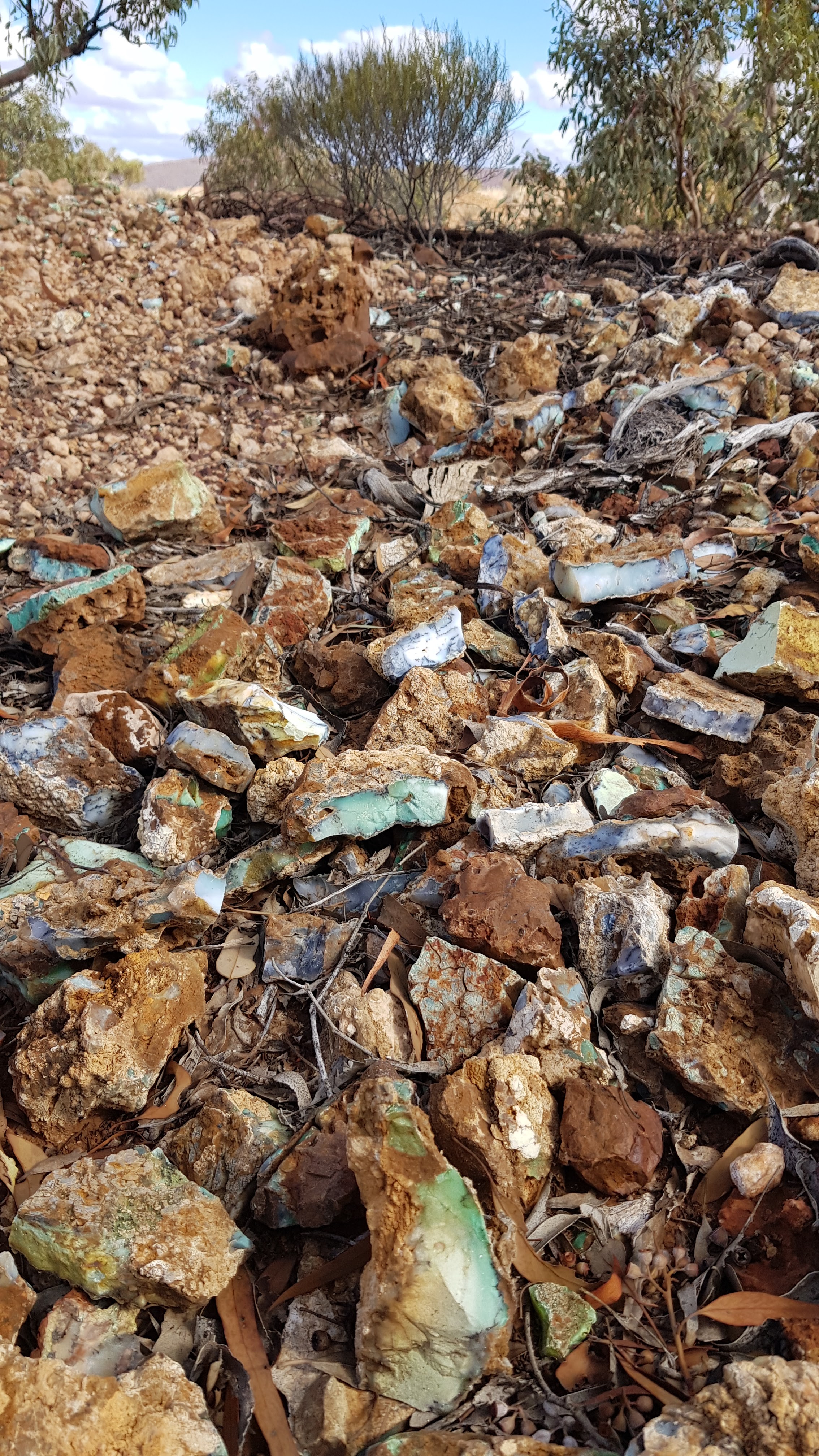
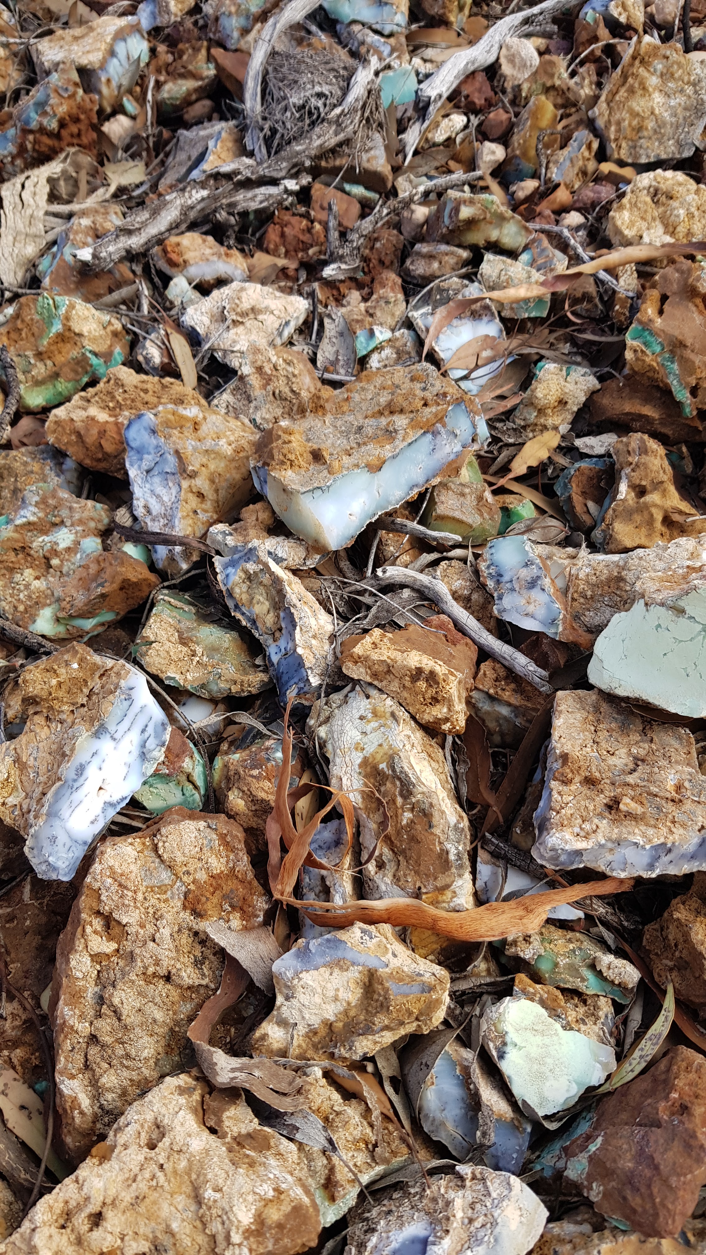
It was a small camp, doing drill testing for minerals in the area. The next day one of the workers offered to take us to the CORNER, where the three states meet, and he also took us up to the top of a hill nearby for a look. There had been exploration done many years ago and the rocks uncovered then were all about. Don’t know what they are called, but they look spectacular, with blues, green and purple hues.


We stayed for 2 days and were thoroughly spoil, even with Dins favorite, a roast dinner, on the last night. With many thanks, we bid farewell, our time at the camp tucked away with our favorite memory’s.


Westward we rolled, on the Blackstone Warburton Road. We only got about 15k out when we came across a small car in the center of the road. A few locals were sitting in the scrub on the side. I stopped and called out, you, OK? The old fella came over and said, no, we run out of petrol. I explained we only had diesel, he looked around a bit and said, yeah. A younger girl, I assume was his daughter, came over and said, you going to Blackstone? Yes, I said, and it was agreed we would let someone there, know of their plight.

A bit down the road a convoy of about 6 station vehicles came from Blackstone way, heading toward them, so we knew they would be taken care of.


That afternoon we came to a Canter truck on the side of the road with a burnt out cab. It had been there for a while, partly scavenged, as are most of the wrecks out here. We camped for the night off the road and in the morning, I obtained a few parts for Ned, along with one, which I had been looking for, for a while. The road was dotted with wrecks in all sorts of condition. Some on the road, some just off, I say it's the community’s auto parts store, they know where to get the part they need.

 The road ends at Warburton on the Great Central Road, where, not too further on, the Gunbarrel Highway starts. Its called a highway, but it is no more than a couple of wheel tracks heading west to Carnegie Station, 300k east of Wiluna, and that, is where we were going.