Wednesday, 10 August 2022

The Jardine River and beyond


After a few days at our secluded oasis, we moved on, refreshed. Only about 45k on was the Jardine River, where we would cross the river on the ferry, the only way across.

Approaching the river you come to a servo, which had no fuel when we were there, lucky we didn’t need any. The office is where you pay for the ferry crossing.

I fronted up and the attendant pointed to a list of prices. I scanned down the list and pointed to the one that said, single car/ vehicle for $110.00. he looked at me and said, you not a car, pointing to Ned. I looked again and the only other category that fitted was, other vehicle under 10 ton, for $220.00. I pointed at that, looked at him and asked, that him? He looked at me, hesitated, then said, I’ll class you as a car this time. Relieved and very thankful I paid him and wished him and his family well, and we proceeded to the ferry.

The ferry waited at the bottom of the steep incline down the bank, we rolled on and were off. The width of the crossing was not more than two lengths of the ferry, so the trip was over not long after it started. I won’t complain about the price as it includes the return journey and camping permits for the sites on aboriginal lands of the Injinoo people who run the service, and it beats swimming the river.


Not far on was the turn off to Mutee Head, one of the sites we were permitted to camp at. We turned off and soon found ourselves at the Point. A steep rocky track wound down to the beach, where a turnaround sported a couple of spots to camp. Backing up a short distance through soft sand we were half under a native cashew tree and side on to a million dollar view over the sand, looking over the ocean to Prince of Wales Island with Thursday Island behind. This we decided, we would make our home for, well, till we moved on.


Weipa turn off to Fruitbat Falls


From the Weipa turn off you follow the route of the overland telegraph line which was completed in 1887 to provide communications right to the tip of Australia and beyond.

As you get closer to the pointy end the bitumen dissapears and the corrugations get bigger. With the amount of traffic on this road it is no wonder that it was so rough.

As you head north you come to Bramwell, a roadhouse at the start of the Old Telegraph Track, the original track following the northern path of the line. This is the last of the truly challenging tracks of the area, mainly because it is not maintained and because of the deep and eroded creek crossings. Because we didn’t have a winch or anyone travelling with us as backup, we took the bypass road called the Bamaga Road. As good as Ned is, the old telegraph track needed more recovery options than he possessed at that moment.


Past Bramwell the corrugations got worse, even so the traffic kept coming, we slowed down to soften the blows but the others seemed to speed up, passing us in clouds of dust. I swear that my right arm is getting bigger with all the winding up and down of the window as cars sped past with the billowing clouds of dust accompanying them. Unsurprisingly, we passed two recovery trucks with disabled 4wds on their backs.

Fruit bat Falls is an oasis and welcome relief from the punishing Bamaga Road. We took the 4k detour to the falls and walked down to the river. Streams of white capped water cascade over the rock shelf spanning the river, plunging a short distance to the emerald pool below. An inviting sight on a hot, northern winters day. Again, many people were there and after having had a good walk around it was time to hit the road again.


Not far up the road we decided to find a camp. A small track seemed promising so we investigated. A few k down the track we rounded a bend and came to a small stream with a clearing, perfect. Once again, a crystal clear, running watercourse with a small waterfall and beautiful plants all about. We have been fortunate to come across some amazing camps and this was one of them, the crowds can have Fruit bat Falls, we have our own private oasis right here. 


Even had a quick dip, all the while keeping an eye out for signs of a croc, while unlikely here, it is never certain there isn’t one about.


One of the unusual plants around was the Picture Plant, a carnivorous plant with a cylinder and a lid, it’s shape looking a little like a saxophone, for catching insects and devouring them. This plant was in abundance around our little stream. Another plant of the area is the Tiny carnivorous Sun dew. We have been fortunate enough to get up close to both of these amazing plants in their special environment.


Portland Roads and Lockhart River


Further north, after Archer River roadhouse, is the turnoff to Portland Roads and Lockhart River Community, a few ks before the actual turn off is a track, which is marked on the map as the old Portland Road. It just cuts the corner for 10 or so ks. As we do, we decided to follow the track. It had not been used for some time and soon deteriorated to a single line through the scrub, but we persevered and enjoyed the drive.


Back on the main Portland Road, we hoped the traffic would disappear, it didn’t, although it did thin out a bit. First stop was Lockhart River Community established in 1924, it was named the Lockhart River Aboriginal Mission at that time. We then went on to the beach a few ks further on.


Large boulders and rock formations dominate the beach, a small stream carves its way through the sand to the ocean, sea birds hang on the strong breeze coming from the east. There is no camping allowed in the area, a shame, what an idealistic location. The local aboriginal council is making improvements to the foreshore and installing picnic shelters and upgrading the roads, it will look good when finished.


Back to Lockhart River and past the Ranger Station up the road, next stop Chilli Beach. This beach is in the national park and the campground is right on the palm fringed beach. We weren't camping as there were no vacancies for weeks, this is a remote campsite, yet it is very popular. We had lunch at the beach then moved on. 


Portland Roads is a small fishing village out on the point, consisting only of a few houses, as well as a café which is popular when open and it was packed when we went past, so we didn’t stop. The trip out to this isolated spot is well worth it, on the way you drive through coastal savanna woodlands then pockets of coastal rain forest and the views over the mountains of the Iron Range national Park are spectacular


It was getting late, so on our way out we found a car park for a walking track a little off the road in the National Park and made it our home for the night.

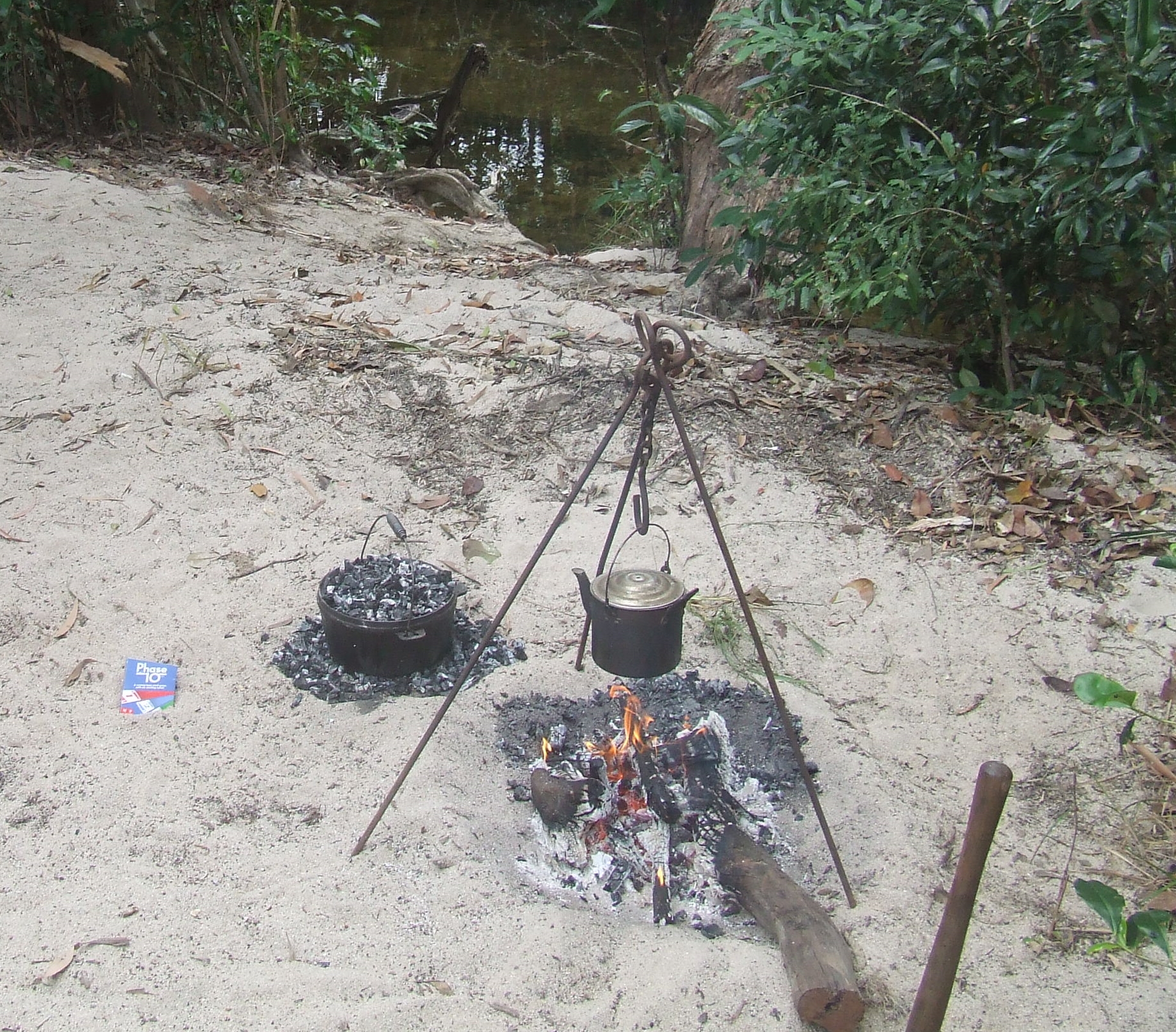
On the way back out to the PDR the next day we found a camp on Browns Creek, another clear, fresh, pristine watercourse. Taking advantage of this top spot we stayed for a couple days and cooked up a roast in the camp oven and counted our blessings.


Moving on a couple of days later, we arrived at Wentlock River crossing, where we had camped on the way out. After setting up camp, we were relaxing, when I heard a snapping and crackling sound from the bush behind us. On investigation, there was a bush fire over the road from us and advancing towards us. Without delay, we packed up and headed down the road away from the flames. Putting the drone up, we could see the fire all on one side of us. We moved on, away from the smoke and flames. Later we heard the local indigenous people were burning off some country as they regularly do to manage the area.


Saturday, 6 August 2022

Cape York


With the busy streets of Mareeba fading into the distance, we steered north, toward Lakeland. At this intersection, you can go northwest to the Cape or northeast to Cooktown, it is also the point you access Lakefield National Park.


Needing camping permits to camp in the park, and knowing that it would be booked out for weeks ahead, we thought, maybe on the way back, Ned veered northwest and we were on our way.

As you get further north you pass through Laura, then Musgrave, no more than a roadhouse and the turn off to Pompuraaw community on the western side of the cape.


Then you get to Coen, a small town with fuel, a shop and a few streets with houses and not much else.The line up for fuel was 10 deep and as we didn’t really need any we went and topped up with water then were on our way.

Gradually, the once dirt track to the Cape is being bitumised, ever shortening stretches of dirt are being covered and you travel for some time on dirt and then long stretches of tar. The days of an isolated adventurous trek to the tip are numbered as the roads improve and more and more people make the trip.


Between Musgrave roadhouse and Coen is the turn off to Port Stewart, we weren't going to Port Stewart, but on the map, you cross a creek not far from the turn off, we were in need of a camp for the night, so went to check it out. What a lovely spot.


We turned up the creek bed just before the causeway and setup camp. Clear, fresh water burbled not far from our front door, parrots and galahs chatted and screeched at each other in the treetops. Stayed there a couple of days and enjoyed the solitude, even though another two campers camped up the creek a way, but not really in sight.


As we moved northward we thought the traffic would thin out, as it usually does on lonely outback roads, but, no, we were constantly being passed or passing others coming from the opposite direction. I kid you not, every 10 minuets there was another car, usually in a group of three or more, this we were not used to, and it only made us more determined to find camps like the one we had just left where we could at least have the illusion that we were alone.

The Tablelands


After spending an enjoyable night and half the next day catching up with our friends, it was time to continue our journey. From Greenvale, it was back to the Lynd Junction and then Northward to begin our trek to the Cape and the tip.


When we arrived at Ravenshoe, we took a road called Silver Valley Road, it wound its gravelly way through the mountains of the Great Dividing Range, at our highest point we were 1025m high. Meandering our way along these thin mountain tracks, it reminded us of the mountain bush tracks of Tasmania.


Eventually we emerged at the little town of Irvernbank, stopping for lunch we took in the sights of this historic, tin and gold mining town. Soon after pushing on there was a track leading to the former dam which provided water to the town, now a water hole on the cattle station of the area. A good campsite. The next couple of days were spent there, washing cloths and cooking on the open fire.


Next stop Mareeba, we stocked up and moved on, the school holidays were on and winter time in far north Qld attracts tourists and travellers like ants to honey.


The streets were filled to bursting, all we wanted to do was leave, a quick visit to visitor info for some maps and info on the cape roads and we were done, so with all we needed on board it was go and find a quiet spot to ourselves. Not an easy thing to find at that moment, but with years of sniffing out secluded spots behind us we eventually had our camp spot.

The Lynd


Having reached the Lynd junction, where the road from Hughenden meets the Gregory Development Road, we turned right and headed for Greenvale. Back a few decades Greenvale was a bustling mining town, the mine producing copper amongst other metal ore. Today the town is having a bit of a resurgence with various projects going ahead in the area. Once empty houses are now filling up and the school apparently has 30 students, good to see this pretty little town coming back to life.

We decided to do a loop around the area surrounding Greenvale, Din had worked and lived at Bluerange Station up the road, in another life, and wanted to check it out, so off we went.

The
Burdekin River came into view and with it, the narrow, grid type bridge, made out of old railway lines. On crossing the bridge the entrance to Bluerange Station was on our left. Spending a little time checking out the station buildings in the distance, we then turned around and headed up a track along the eroded river bank. Some distance up, a suitable camp spot presented itself to us, we stopped and set up.


Continuing on in the morning we passed a few waterholes and dams, the summer rains had been kind and most depressions had water in them, a rare thing in these parts.


 Passing by Camel Creek Station, we waved an unnoticed hello, a friends family own the station.


 A fork in the road soon came up, left, to continue the loop, or right to go out to a national park on the Burdekin River. The right turn won the debate and we turned to explore.

Girringun National Park includes a former cattle station, now given over to the National Parks. The road or should I say track was rough and crossed a few shallow running creeks, just how we like it. Having had a good look around, we decided to head back to our original journey.


Valley of the Lagoons was next, this station sits in a beautiful valley, as the name suggests, with water filled lagoons dotted amongst it


. Picturesque views abound as you travel the road through the property. Also large signs, warning if caught camping on the property, you would be in trouble. As usual, some inconsiderate, single minded, yobbos have obviously stuffed up the chances of all, by doing the wrong thing. We always respect the environment we stay in and often clean up after others, leaving no trace we were there at all. That is the way it should be for all enjoying this vast, beautiful land.


Our loop nearly completed, we headed out to the main road and back to Greenvale, where we were due to meet a couple of friends travelling through.