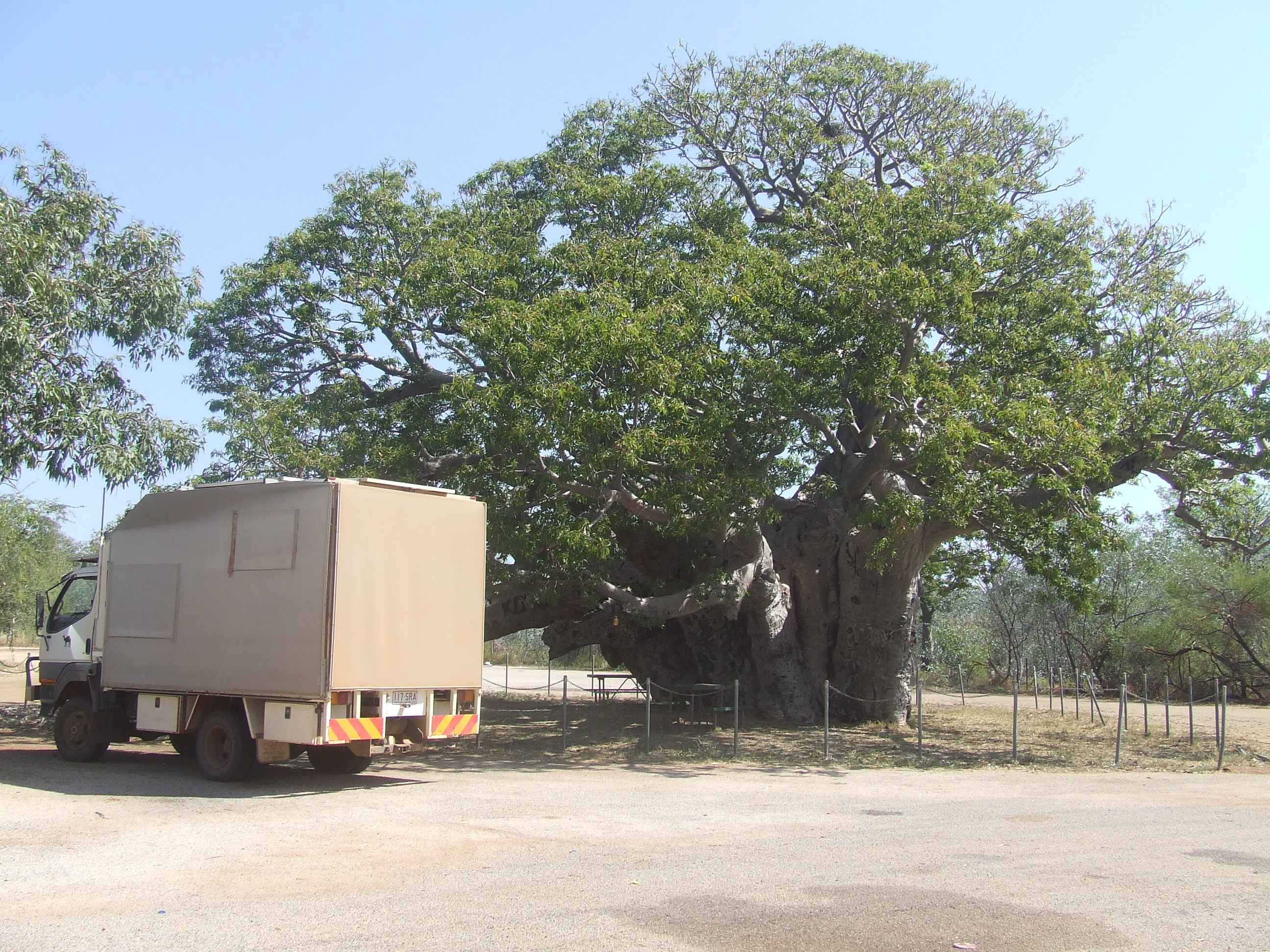
Thursday, 9 June 2022

Urandangi to Winton


We turned south, the road to Urandangi was dirt but looked freshly graded. Green vegetation suggested a good wet season and the skies were holding patches of grey, rain filled clouds. After a few hours, an inviting creek turned up and being late, we climbed onto a high spot and set up camp. The creek was dry but the trees provided shade and it was a pleasant camp.


Morning saw us back on the road and at Urandangi, a small, collection of houses and a pub. The following video is a tour of town.


After a beer at the pub, sitting on the verandah, a rain storm came over dumping a lot of water on us. We were going to camp up at the pub for the night but the publican said a big rain band was moving towards town and we might be stuck for some time if it hit, so with that, we decided to keep moving. Topping up fuel, luckily Ned only needed a bit as diesel was $3.00 per liter, we hit the road. A couple of hours later we were on the bitumen and on our way to Boulia.


Managing to stay ahead of the rain, two days later the town of Boulia appeared in front of us. Finding a secluded spot on the river we camped up for the next couple of days.

It was time to move on so a few essentials from the shop and a full tank of fuel we hit the Boulia winton road. This road we have done many times but never had we seen it so green. For a while we thought we were back travelling through Austria or Switzerland. Brown water filled creeks and holes where everywhere. This road never dissapoints with a wonderful array of sights, from the endless plains stretching to the horizon, made more spectacular by the,now, blinding green colour, then, cone shaped and ruggard faced measers appear in the distance. When you draw closer, the landscape transforms into a scene from a dinosaur age. Spectacular land forms, some with shrubs and trees dotting their surface surround you. These sights never fail to amaze us.


Middleton is about half way to Winton, all it is, is a pub in the middle of nowhere. Middleton pub has been in continuous operation for over 130 years. An old cob and co coach stands defying the weather outside the building. This was our camp for the night. As always we had a drink at the bar and ordered a meal to support the pub. 


Next day we called into a shack five ks from Middleton, this was built as a set for a movie shot here called Goldstone. The shack was looking a bit forlorn, some of the roof being ripped off by the sometimes ferocious winds here.


With more great scenery to come we were off to enjoy our journey to Winton.


Monday, 6 June 2022

The Sandover


A short trip down the bitumen and we were at the turn off to the Plenty and Sandover highways. The Sandover was the one we were going to follow.


Started off smooth and just graded, but as all good things, it didn’t last. Once again we slowed down and took in the passing scenery.


On the Tanami, we had counted 25 wrecked and abandoned cars, not long down the Sandover the count started again. These remote roads have their own version of car parts stores, cars of all sorts in varying states of disassembly.

This road was 550k to Lake Nash on the Qld boarder then 150 more to Urandangi where we would refuel. By the time we made the boarder we had counted 24 cars, being a shorter road we concluded it was worse in the car wrecking department. 


After a few days enjoying the road we hit Lake Nash and continued on and crossed the boarder. Back in our home state after over three years away, the rain was following us and slowly catching up, not that it worried us now, we were on the bitumen and would be for some time now. We now had to decide where to from here, it would be back to our property soon, but, no need to hurry.


Sunday, 5 June 2022

The Tanami


A group of large Boab trees on ether side of the road greeted us at the start of the Tanami track, like a send off committee, wishing us luck.


Our first stop was to be Wolf Creek Crater, the second largest meteorite crater in the world. 900 metres across and only discovered in 1947 by people doing an aerial survey of the area. 


The crater is over 120k down the track, road conditions were good in most parts, with stretches of large corrugations, which slowed us down. By afternoon the crater was in sight, the last eight ks were badly corrugated and we crept into the campsite and set up, the sight seeing could wait till morning.

With brekky done and packed up again, we drove the last k to the crater. A steep walk up the side and you are faced with the sight of a 2,000,000 year old hole, 20m deep, but originally up to 120m deep, time and forces of nature have filled the hole to the depth it is today, rimmed with the mound of earth created when the meteorite ended its journey through space. An awe inspiring sight.


After contemplating the magnitude of space and even the land where I stood, and how it makes you feel so insignificant, I recorded some video and some still pics to show Din, as she couldn’t do the climb to the top, I descended again.

This was a 30k side trip off the road, but well worth the travel. Back on track, we continued, the road was getting slowly worse. This was expected, as most of the traffic were road trains pulling four or more heavily loaded trailers creating huge corrugations for as far as you could see. The only way to lessen the impact of these machinery destroying bumps, is to lower tyre pressure and go slow, this we did.

Billiluna, the first of two Communities along the track, was where we next camped at least, on the creek bank near the turn off, as no one was allowed to enter the community re Covid rules. 

We woke in the morning to the cheery shrieks and cry's of pink and grey galahs and red tail black cockatoos, as well as Major Mitchel cockatoos, all shouting out a good morning from the treetops.


Pressing on, further down the track, Balgo, the next community passed by. This is also the northern end of The Canning Stock Route, which starts at Wiluna. The road wasn’t getting any better, an average speed of 25kph was bearable, but Ned was born for these roads and was taking it in his stride.


The road is fairly wide, to accommodate the road trains using it, you can see anything coming for miles by the telltale cloud of dust on the horizon, so to minimize the bone shaking rattling, you scan the road ahead and go to the smoothest part, even if you drive on the wrong side of the road most of the time. A lot of the time the best place is right at the edge, where the surface is soft and less prone to form corrugations, but if they are there, at least they are softer to go over.

After quite a few days travelling we hit the WA / NT boarder. A very understated marking of the divide between states, a large drum painted up to mark the 129th parallel.


Crossing the boarder we carried on for a while, then pulled into a track leading to a disused bore and camped up. Here I recorded out first NT sunset as I waited for our roast potatoes and pumpkin to cook in the coals of our camp fire.

As always, the footage doesn't bring out the true colours, but spectacular anyway. These were our sunsets and sunrises every day, you just can’t help but be in awe of nature with this as your backdrop.


Mount Doreen, more a hill than a mountain, but an impressive granite formation none the less, came up on us and a track led us to the ruins of a once bustling, it would seem, settlement. The remnants of a former life were scattered about, large bits of rusting machinery with oversized cogs and gear teeth grimacing in the long grass. Vintage trucks once tireless workhorses, now skeletons, resting beneath the knurled branches of desert gums. An old stone, one room shanty crumbles into the ground.


It would have been a hard life here, whatever they were doing, there was evidence of mining, an old shaft in the hill nearby, and the large machinery decaying, left where it stood.

We drove down to a dry creek bed and camped for the night on it’s banks. After a bit more exploring in the morning, we set off toward Yuendumu, a community marking the end of the dirt road of the Tanami.

Driving into Yuendumu, the local welcoming committee, a mean looking, large dog, ran beside Ned and threatened to chew off his tyres, but decided he had better things to do after a few hundred metres and left us alone.

The local store was well stocked and we bought some salad and bread then fuelled up. Our journey down the Tanami, so far, some 830k had used up just over 100 litres of fuel, not as much as I had envisioned. Going at the slow pace as we had to, had decreased our fuel consumption.

We had a choice, go down the buitumin to the Stuart hyway, or go on the gravel, Mount Denison road, also to the hyway but coming out a bit further north. The dirt road won out.

Asking around town, no one seemed to know what condition the road was in. even tried at the police station, but could not find any body there. So, as we do, we set off down the road and knew we could always turn back if it was impassable. About thirty k on, a grader came hurtling round a bend and screeched to a stop as we were exiting a dry creek crossing. Seizing the opportunity, I signalled to the driver and we stopped too. He told us the road was good all the way to the highway, and in fact in another 20k it had been just graded to the end. We thanked him for the info, and for his work on the road and took off with the happy thoughts of smooth roads ahead.

In two more days, we hit the buitumin of the Stuart highway. Over 1000k from Halls Creek on bone shaking, teeth rattling, slow going, wonderful roads. This is why we travel, it’s not the destinations, it’s the journeys between, the majestic scenery, the immersing yourself in the landscapes, the finding of little wonders others have passed by because they are on a schedule or fail to take the time to see the beauty around them. We, I think, are blessed.

Refueld at Aileron Roadhouse then 60k down the blacktop and turn off to our next adventure, The Sandover Highway, to Qld.


To Halls Creek


With tyres back to bitumen pressure, it was highway driving again. Sandfire roadhouse was just up the road and we stopped for fuel, then on to Broome, where we were to do a last supply stock up, as it was the last major town before we started down the Tanimi track heading for Alice Springs in the NT.

330k of bitumen road to Broome, not very exiting, but the low coastal landscape kept us entertained as usual. A couple of overnight camps, keeping up our normal hectic pace, and we were at the turnoff to Broome, sneaking off into the bush at a truck pullover bay, we setup for the night.

In the morning, after brekky, we ventured into town. Today was a week before election day, we found the early voting center and cast our vote. Then to the supermarket to stock up. With food cupboards full, then water tanks topped up, we did a drive around Broome. It had grown a bit since last we were there, but still managed to keep most of its old charm, nice little place with a wealth of history.

Back to the road and as we wandered eastward the landscape changed from the low shrubs of the coastal plains to more taller gums and some rocky outcrops looming in the distance.

180k east a narrow, one lane bridge crosses the Fitzroy river and at the other side is Willare Roadhouse. We crossed the river and checked out the roadhouse. A dusty, red earth, bit barren place. We didn’t need fuel, and on the other side of the river where we had come from, there was a campsite by the river, so back we went and found a spot.

The night was hot, 36 degrees during the day, and it didn’t seem much cooler at night. During the night crocks could be heard barking in the river below. After scouting about and bagging up litter and the ever present loo paper found even in the most remote places, some people have no respect for this beautiful land, it was time to go.

On to the small town of Fitzroy Crossing. Boab trees now become prominent in the landscape. These ancient, magnificent, trees stand out proud amongst the other vegetation, looking like sentinels, watching over the land. At one rest stop, a huge specimen stands proud in the centre. Too bad lots of people felt the need to carve their names in it’s life giving bark. This tree would be hundreds of years old.


More fuel at Fitzroy Crossing, then back on the road. More narrow, one lane bridges across wide flood plains of creeks and rivers, the rocky ridges, closer to the road, are a wonderful sight, colours of orange and brown with streaks of white on their time worn faces.


A little way before Halls Creek we stopped at Margaret river, a campsite that was popular with travellers. We rolled in at lunchtime and there was already a little crowd camped by the river. Finding a tucked away corner we also camped up. As evening came, so did the campers, filing in with some regularity. By morning, when I looked outside, the place was packed. By the time we had had breakfast and contemplated the new day, the place had almost emptied out. 


Halls Creek, our last chance to stock up before the 850k trek across Tanami. Being well stocked with food, a last top up of fuel and water was all we needed. It was near midday when the town came into sight, so we continued on to the site of the original Halls Creek town, about 20k further east. Scouting about the old town ruins when we arrived, there was a track leading to a little spot near the water, this was our camp for the night.


Morning arrived, and into town to fuel up and back out to the start of the Tanami.